
MS-DT Program Capstone Project
Team: Emad Alqattan, Chris Byerly, Ana Faria Defino, Mathew Jensen, Han-yuan Tsao, David Zhu
Instructor: Karl Daubmann
It all begins with the classical struggle between urbanism and modern transportation. A functioning city requires efficient traffic arteries, which historically has been irresponsible for its impact on the surrounding area. In this project, we see the conflict between traffic and local city fabric as a conflict of different rules. Instead of trying to search and provide a “solution” to reconcile the conflict, we ask: what could a city look like if both its transportation and local fabrics follow the same set of rules? And what would be these rules?
The project site is to the east side of Chicago’s O’hare airport. 3 interstates meet in the site and create a huge node of ramps and ramifications. There is nothing but grassland inside this node. The remaining city fabric close to the node is scattered and fragmented, and is mostly orthogonal pattern that speaks to the rest of the city, which is either separated from the site by interstates, roads or forest park to the east.

Overview of our approach: we established a hierarchy of 3 urbanistic layers, and assigned rules for each of them. More importantly, we created a chain of algorithms to link these layers into one.
The start point of this chain is the transportation system, which only follows rules of car; The inter-medium layer is city grid, which receives input from transportation system, breaks down the scale and fills the space; The end point of the chain is street blocks and buildings, which is most relevant to rules of human. The outcome of the last layer will be the source of feedback to the first layer, then another iteration begins.

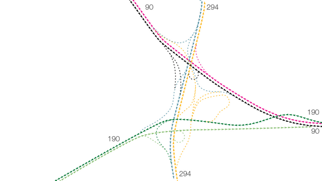
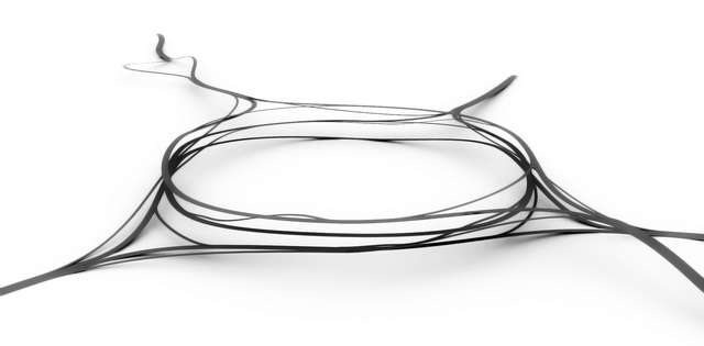
We choose a roundabout as the form for the node that connects 3 interstates. All the existing connections were re-configured into their new form. Each of the components of this node is constrained by the same set of rule of speed – radius, slope, number of lanes, exit direction, etc. They are parametrically linked so the change of one will immediately affect others.

Then the algorithm will generate an urban grid following 3 rules: morphology, gradient and emergence. Morphology rule tells the algorithm to follow and fill the shape and space that is left by the layer above; gradient rule assigns functional “preferences” to different locations of the site, and makes a gradual change accordingly to the gird pattern; emergence rule “randomizes” the grid, give it a more natural pattern, which supposedly creates opportunities for attractive urban spaces.
The irregular leftover space is evenly divided into blocks that are approximately rectilinear, which serves as input for the next layer.

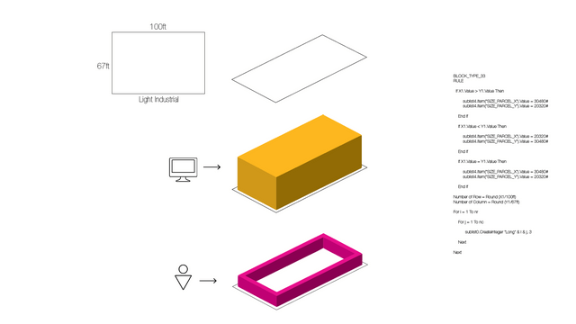
There are 3 major types of street block in the final layer: residential, commercial and industry. Within these types, there are sub-types that returns a mix of major types. The algorithm will take the output from the layer above, use the set of rules of its own to decide the type for each block, and finally populate all the buildings.


Finally, full iterations through all three layers are achieved.


